December 2012
| December 2012 |
2nd Virtual Conference (VIC02) | |
|---|---|
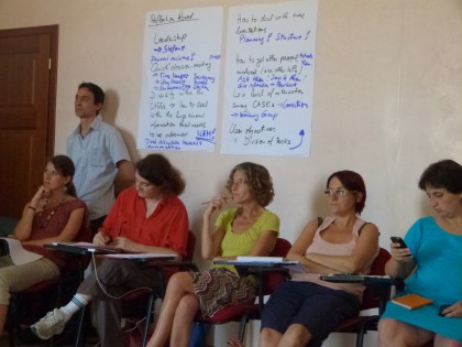 The Second PEGASO Virtual Conference took place from 8 to 19 October to examine possible approaches, select a set of common indicators for evaluating Integrated Coastal Zone Management (ICZM), analyse the regional Mediterranean and Black Sea Assessments and explore the links between indicators and spatial data infrastructure (SDI). After fruitful discussions, the methodology and the preliminary set of indicators proposed were accepted by all partners. Methodological factsheets for the calculation of individual indicators and their future use by PEGASO partners and end-users will provide a harmonized method for assessing the ICZM Protocol in the future. Discussions focused on the relevance of each indicator, the scoring system for testing compliance and the amount of background information required to complete each one. Furthermore, the Virtual Conference provided a training forum on how to use the ecosystem accounting tool LEAC (Land and Ecosystem Accounting for Sustainability) to evaluate coastal sustainability, with a few practical examples from the French case study of Bouches du Rhône. With regard to integrated regional assessment (IRA), the VIC02 participants discussed the concept note and the proposed preliminary outline. Due to the large amount of information available on the coastal environment, the participants agreed to focus the preliminary analysis on the governance and institutional framework. CASES could also be an opportunity to show the relevance of the problems that IRA will need to consider at the regional level. Some caution was raised among partners regarding up-scaling the results from CASES to any national or regional situation: the lack of updated coastal information could undermine the results, which might not fully reflect other realities. Cumulative impact analysis could offer a diagnosis and provide a basis for prospective analysis of the coasts. The upcoming outputs and deliverables from other working packages will help to better shape the structure of the regional assessment. More info: f.santoro@unesco.org | |