April 2013
| April 2013 |
Spatial Data Infrastructure Brochure for stakeholders | |
|---|---|
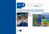 A major challenge in applying the recently adopted Integrated Coastal Zone Management (ICZM) Protocol for the Mediterranean to help decision making is the integration of different types of data, together with the fragmentation of institutional responsibility for coastal areas at regional, national and local levels. A new brochure for local and national stakeholders has just been released as a PEGASO communication tool to raise awareness of the opportunities arising from use of Spatial Data Infrastructure (SDI) in ICZM. This brochure, available in French and English, explains the advantages of using new spatial technologies and spatial information to store data and their attributes, as a means to discover, visualize and evaluate related coastal information and help in decision making. The brochure describes the three tools that ensure easy access to data and information within the PEGASO project: the Catalogue, the Map Viewer and the Atlas. The brochure was elaborated by the PEGASO partner, the IUCN Centre for Mediterranean Cooperation. More information on the brochure: Mar Otero (IUCN-Med) Information on the development of the Pegaso SDI: Gonzalo C. Malvarez. | |